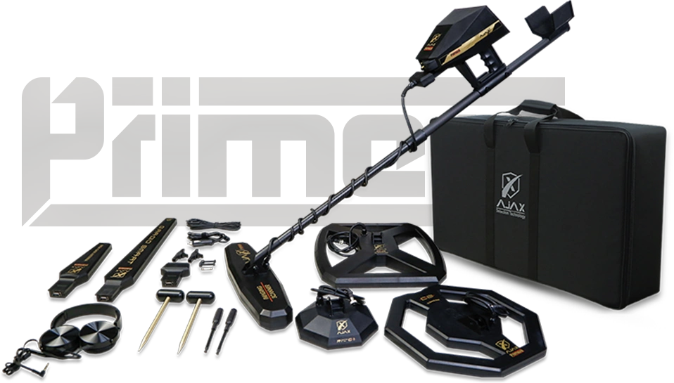
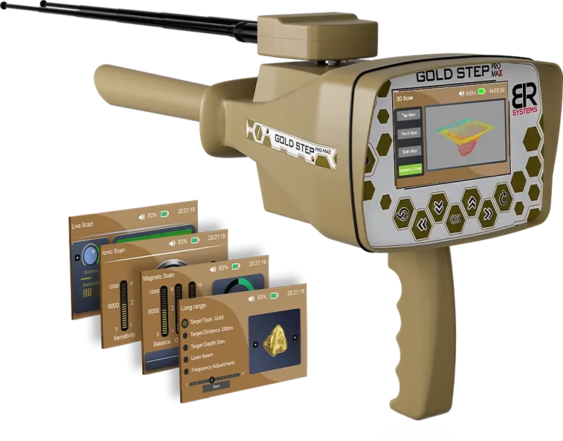
Ajax Primero MD15 Metal & Gold Detector
The Ajax Primero MD15 is a multi-system metal and gold detection platform designed for advanced field exploration. It supports the detection and analysis of metallic targets, subsurface structures, and underground anomalies under different ground conditions.
The system integrates multiple detection modes to assist in identifying metallic objects, natural gold occurrences, voids such as caves and tunnels, and subsurface variations. It also supports the analysis of soil layers and geological conditions during field operations.
Primero MD15 combines signal processing, ground scanning, and analysis systems within one platform, supporting structured workflows and target evaluation. The system is designed for use in different terrains, including mineralized and complex environments, assisting users in interpreting detection signals and identifying potential target areas.
The device integrates multiple detection systems developed to support signal analysis and improve stability during field use. It is suitable for professional users and advanced applications requiring structured underground exploration and data interpretation.
The Ajax Primero MD15 is designed for users looking for a professional multi-system solution for underground exploration and target analysis. It is suitable for:
- Professional prospecting and survey teams
- Archaeological specialists and field researchers
- Companies involved in geological and exploration projects
- Experienced detector users
- Professionals requiring detailed signal analysis before excavation
Primero MD15 combines multiple detection and analysis systems within one platform for structured field exploration.
Operating Environments
The Ajax Primero MD15 is designed for field exploration across different terrain and soil conditions, including:
- Dry and sandy environments
- Mountainous and rocky terrain
- Agricultural fields and open areas
- Forested and humid environments
- Clay-based soils
- Mineralized ground
- Archaeological and historical locations
Its integrated detection and analysis systems are designed to support field operations across different search environments and ground conditions.
While the Primero MD15 incorporates 15 detection and analysis systems, these systems are organized into four main technology platforms designed to support different methods of underground exploration.
Long-Range Detection Platform
Designed for long-range exploration and directional target searching using the available automatic, manual and ionic detection systems.Ground Imaging Platform
Supports ground scanning and visual analysis of subsurface data, helping users evaluate underground anomalies and potential target areas before excavation.EFM Platform – Detection & Signal Analysis
Combines detection and signal-analysis functions for metal discrimination, graphical readings, target localization and additional target evaluation.Geophysical Platform
Uses geophysical measurements and electrical resistivity analysis to evaluate subsurface conditions, including geological variations and potential groundwater locations.By integrating these platforms, the Primero MD15 provides:
- Multiple methods for underground exploration
- Metal detection and discrimination functions
- Ground scanning and subsurface visualization
- Signal and target analysis
- Geophysical and groundwater exploration
- Different tools for evaluating potential targets before excavation
The four platforms work together within the Primero MD15 as an integrated multi-system detection and analysis platform.
The Ajax Primero MD15 integrates fifteen detection and analysis systems within one multi-system platform. Each system is designed for a different stage or method of underground exploration, including long-range detection, ground scanning, metal discrimination, target analysis, geophysical exploration and groundwater detection.
1. Automatic Long-Range System
Designed for simplified long-range exploration without extensive manual configuration. The system assists in searching for metallic targets and provides information related to target direction and search progress.
✔ Automatic operation
✔ Simplified search process
✔ Target direction assistance2. Manual Long-Range System
Provides manual control over different search parameters and allows the user to configure the system according to the intended target and search area.
Available settings include:
- Metal type (Gold – Silver – Copper – Iron)
- Search parameters
- Forward search range
The system provides directional indications during field exploration to assist the user in approaching potential target locations.
3. Ionic Long-Range System
Designed to analyze ionic field variations associated with buried metallic targets. The system can be used during long-range exploration for different types of metals, including gold, silver, bronze, platinum and copper.
4. Gradio Smart System
Designed for ground analysis using variations in magnetic fields. It can assist in identifying metallic targets and underground voids and can be used as an additional method for evaluating potential target locations.
5. Live Scan System
Provides real-time visualization of scanning data using color indicators:
- Green: ground characteristics
- Red: metallic responses
- Blue: void responses
The system helps users interpret changes detected during the scanning process.
6. Ground Sonar System
Designed for preliminary ground inspection by transmitting signals and analyzing responses associated with changes below the surface. It can assist in identifying anomalies related to voids, tunnels, caves and metallic targets.
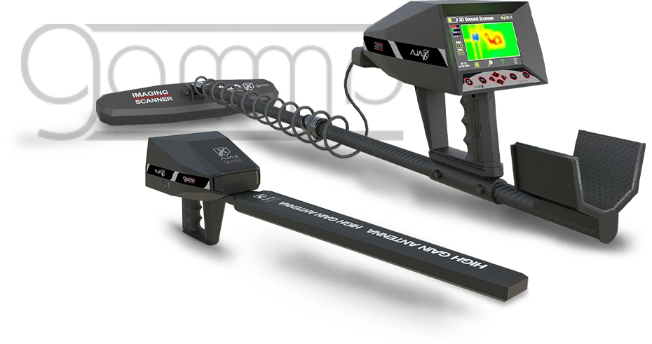
7. Ground Imaging System
Designed for subsurface scanning and visualization. Scan results can be viewed on the device or analyzed using the included tablet and Primero MD software.
The system uses four main sensors and provides visual representations of detected underground anomalies to support further target evaluation.
8. Graph System
Displays detection data in a two-dimensional graphical format to assist with evaluating:
- Target boundaries
- Signal characteristics
- Target density
- Estimated depth
The system can be used as an additional target-analysis method after detection.
9. Discrimination System
Designed to assist in differentiating between different metallic responses. The system displays target information on the device and includes an iron rejection function.
10. Pinpointer System
Used during the final stage of target localization. It helps narrow the detection area and identify the approximate position of a detected metallic target.
11. Quick Scan System
Designed for rapid preliminary scanning. The system provides audio and visual indications when a detection response is registered and helps users evaluate potential metallic targets during field exploration.
12. Spectrum Analyzer System
Provides additional graphical analysis of detected targets. The system analyzes detection signals using compatible search coils and displays information that can assist with target evaluation.
13. Automatic Geophysical System
Designed to analyze variations in electrical resistivity and subsurface conditions. The system assists with evaluating underground formations and anomalies associated with different subsurface materials and groundwater.
14. Manual Geophysical System
Provides manual control over geophysical measurements and allows users to examine selected areas or specific points in greater detail. It can also be used to compare and evaluate previous survey results.
15. Imaging Geophysical System
Designed for groundwater exploration using collected geophysical data. The system converts survey measurements into visual information to assist users in evaluating potential groundwater locations and selecting areas for further investigation.
The Primero MD15 combines ground imaging technologies with calibration functions and dedicated Primero MD software. Scan data can be viewed directly on the device display or analyzed using the included tablet and software.
Ground Imaging Capabilities of Primero MD15
The ground imaging system is designed to visualize and analyze subsurface scan data and assist users in evaluating underground anomalies.
Key capabilities include:
- Two-dimensional and three-dimensional ground imaging
- Visualization of subsurface and soil variations
- Analysis of responses associated with metals and underground voids
- Color- and shape-based visualization of scan data
- Evaluation of target characteristics before excavation
Soil-Based Calibration
The system provides automatic and manual calibration options for different ground conditions, including:
- Clay soils
- Rocky terrain
- Sandy ground
- Mixed and mineralized soils
Calibration helps users adjust the system to local ground conditions and can assist with:
- Adjusting measurement readings
- Reducing the influence of ground interference
- Improving signal interpretation
- Supporting more consistent scan analysis
Result Interpretation & User Control
Users can:
- View scan results directly on the device display
- Analyze collected data using the included tablet and Primero MD software
- Examine scan data through visual representations
- Review collected information before excavation
The software provides an interface for viewing and analyzing field data collected by the Primero MD15.
The Primero MD15 is designed for practical field use with a lightweight and durable construction. Its ergonomic design provides balanced handling during extended search sessions and supports comfortable operation in different field environments.
The device can be assembled and disassembled for transport and storage, making it suitable for mobile field operations and different exploration locations.
User Interface
The Primero MD15 features a user interface designed to provide direct access to its detection, scanning and analysis systems. Users can navigate between operating modes, adjust available settings and view detection information directly on the device display.
The interface is designed to support efficient operation of the Primero MD15 systems during field exploration.
Technical specifications
Detection System Multi-detection systems and functions, contains 15 optional systems Operating Principle Processing data and digital signals and converting them to visual and audible results Processor Architecture ARM Microcontroller 32 bit Display Screen TFT Color LCD, 800 x 480 WVGA, 16-bit color depth Battery 12 volts, 3300 mAh Power Rating 400 mA Battery Endurance Typical usage time 10 hours Power Adapter USB TYPE-C / PD / 1.5 A-30W Storage It can save to 50 scans. Sound High quality sounds, 32 KBIT/S, MP3 Notifications Sound and tactile feedback configurable in the settings menu for Bluetooth 2.4 GHz, sensitivity up to -80dBm. Languages Multilingual User Interface with support for 8 languages. Date and Time Real Time Clock could be set manually or Automatically via GPS time. Login Restriction Configurable PIN. Overall Dimensions 88x52x20 cm Package Total Weight 10.2 Kg Operating temperature From -10° C to 60° C (14° F - 140° F) Storage temperature From -10° C to 80° C (14° F - 176° F) Humidity Could be stored and operated at relative humidity level up to 90%. The Primero MD15 is designed for field exploration across different ground conditions, including desert areas, agricultural land, rocky terrain and clay soils. Its soil calibration functions allow users to adjust the system according to local ground conditions, including mineralized environments.
Archaeological & Subsurface Exploration
The system can be used for subsurface exploration where users are searching for underground anomalies, voids, tunnels and other structures. Its ground imaging and analysis systems provide additional information that can be evaluated before excavation.
Gold & Precious Metal Prospecting
For gold and metal prospecting, the Primero MD15 combines multiple detection methods, including metal discrimination, ground scanning and long-range search systems. These tools support the evaluation and localization of potential metallic targets before excavation.
Advanced & Professional Exploration
The Primero MD15 combines its detection, scanning and analysis systems within a single platform. Its interface provides access to the available search modes and displays detection information to support both experienced detector users and professional field applications.